The ultimate aviation test

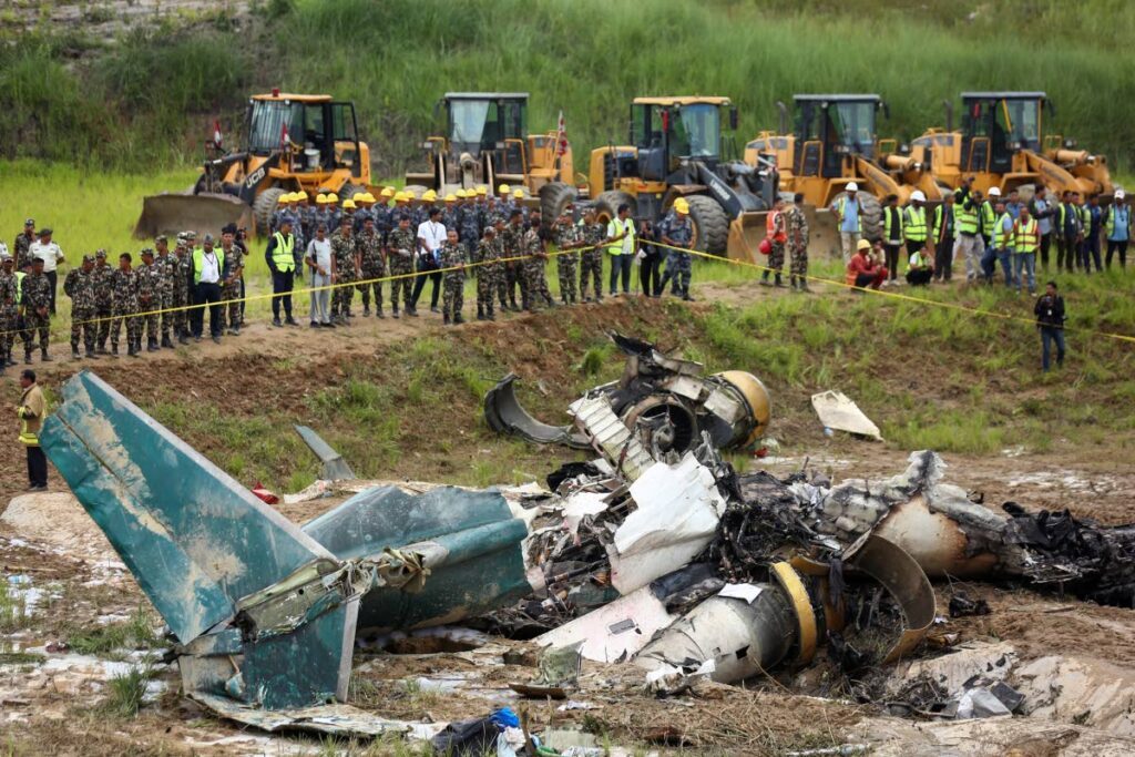
ON JULY 24, shortly after takeoff, a 50-seater Bombardier CRJ-200 passenger aircraft belonging to Nepal's Saurya Airlines crashed and caught fire while taking off from the Tribhuvan International Airport, in Nepal’s capital, Kathmandu, killing 18 people on board. Airport officials said only the captain survived.
The Himalayan country is wedged between India and China and is heavily dependent on air connectivity because of its limited road network. Nepal remains isolated from the world's major land, air and sea transport routes.
However, its aviation industry has boomed in recent years, carrying goods and people to hard-to-reach areas. The country has 32 airports, three international and 29 domestic.
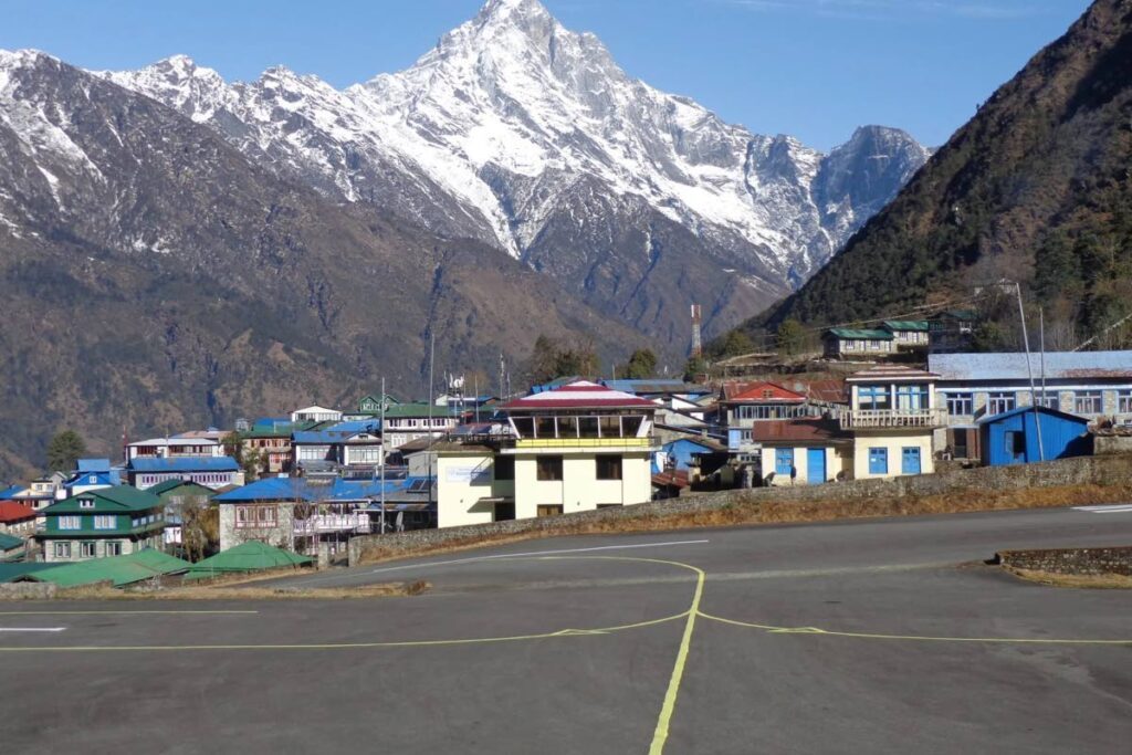
Nepal has some of the world’s most challenging runways for aircraft to land. Many are flanked by snow-capped peaks with approaches that sometimes put a pilot’s skills to the ultimate test.
The weather can change quickly in the mountains, creating dangerous flying conditions.
Tribhuvan International Airport is in a valley surrounded by mountains on most sides with a tabletop runway. This is a runway on top of a plateau or hill with one or both ends adjacent to a steep precipice which drops into a deep gorge.

Large aircraft have to fly through an opening on a mountain to land at Tribhuvan Airport.
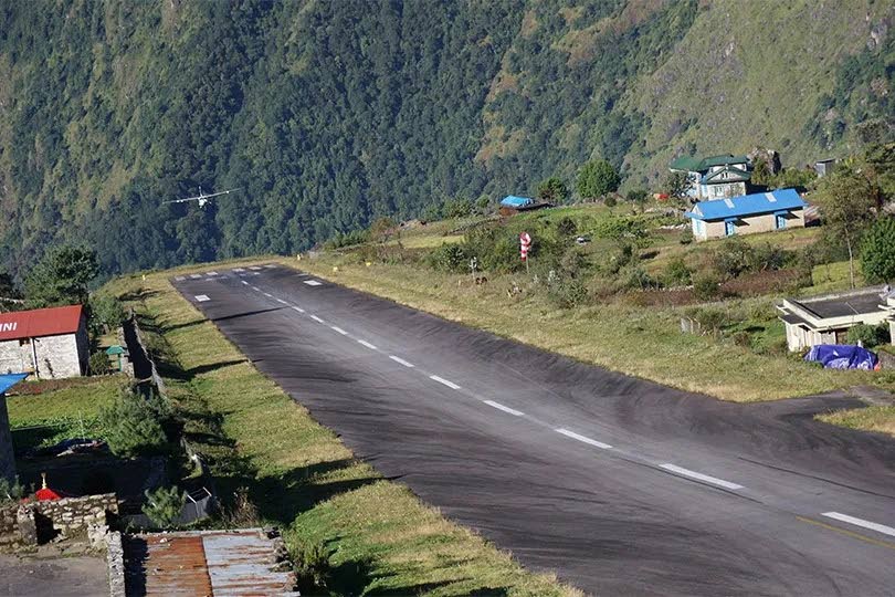
Tenzing-Hillary Airport, also known as Lukla Airport, is a domestic airport in the town of Lukla, in the Koshi Province of Nepal. It gained worldwide fame when it was rated the most dangerous airport in the world for more than 20 years by a programme titled Most Extreme Airports, broadcast on The History Channel in 2010
The airport is popular because it is the starting point for treks to the Mt Everest base camp.
There are daily flights between Lukla and Kathmandu during daylight hours in good weather. Although the flying distance is short, rain commonly occurs in Lukla while the sun is shining brightly in Kathmandu. High winds, cloud cover and changing visibility often mean flights can be delayed or the airport closed.
The airport was built in 1964 under the supervision of Sir Edmund Hillary, who originally intended to build it on flat farmland. However, local farmers did not want to give up their land, so the airport was built in its current position. Hillary bought the land from local Sherpas for US$2,650 and involved them in building it.
It has been said that Hillary was unhappy with the runway's soil resistance, and his solution was to buy local liquor for the Sherpas and ask them to perform a foot-stomping dance to flatten the land that served as the runway. The runway was not paved until 2001.
In January 2008, the airport was renamed Tenzing-Hillary Airport in honour of Sherpa Tenzing Norgay and Hillary, the first people confirmed to have reached the summit of Mt Everest, and to mark their efforts in the construction of the airport.
The airport's paved asphalt runway is accessible only to helicopters and small, fixed-wing, short-takeoff-and-landing aircraft, such as the Canadian De Havilland DHC-6 Twin Otter, Dornier 228, L-410 Turbolet and Pilatus PC-6 Turbo Porter.
The runway is 1,729 feet long and 98 feet wide, with an upward 11.7 per cent gradient that helps to slow down landing aircraft.
The airport's elevation is 9,334 feet, with reduced air density that affects the aerodynamic performance of aircraft.

The airport is used for passenger flights and for transporting most building materials and cargo to Lukla and other towns and villages to the north of Lukla, as there are very few roads to this region.
During early mornings, the wind is usually from the northeast, changing to a southwest wind from mid- to late morning owing to the effect of the sun on the mountains to the north of Lukla. Consequently, flights are usually scheduled for the early morning.
Visibility problems close the airport 50 per cent of the time during the monsoon season, with the consequent cancellation of 50 per cent of flights. The terrain minimises the possibility of a safe go-around for a missed approach, and there are no published go-around procedures for this airport.
Arriving and departing aircraft must use a single Runway 06 for landing and Runway 24 for takeoff. There is high terrain immediately beyond the northern end of the runway and a steeply angled drop at the southern end into the valley below.
Owing to the difficulties of successfully landing there, the Civil Aviation Authority of Nepal sets high standards, according to which only experienced pilots who have completed at least 100 short-takeoff-and-landing (STOL) missions, have over a year of STOL experience in Nepal, and have completed ten flights into Lukla with a certified instructor pilot, are allowed to land there.
There have been 11 accidents at the airport. The worst occurred on October 8, 2008, when a DHC-6 Twin Otter 300 operating Yeti Airlines Flight 103 crashed on final approach and caught fire, killing 18 passengers and crew. The captain was the only survivor. Video of the incident showed bad weather at the time.

Photo courtesy Ramesh Lutchmedial -
The Nepalese Government has been working to improve the infrastructure and safety levels to make Lukla Airport a safer and more reliable option for trekkers and climbers visiting the Everest region. The government has extended the runway by 200 metres, making it possible for larger planes to land and take off. This extension has also increased the safety margins for planes landing and taking off.
The government proposes to instal an approach radar system and an instrument landing system (ILS) to improve overall airport safety.
These systems will help pilots navigate the challenging terrain and ensure a safe landing.
The terminal building was expanded to accommodate more passengers and improve the overall airport experience. This expansion has also improved the handling of baggage and cargo.
The government has mandated the continuous training and monitoring of airport staff to ensure that they are competent and capable of handling the demands of the airport to enhance safety and efficiency.

Comments
"The ultimate aviation test"