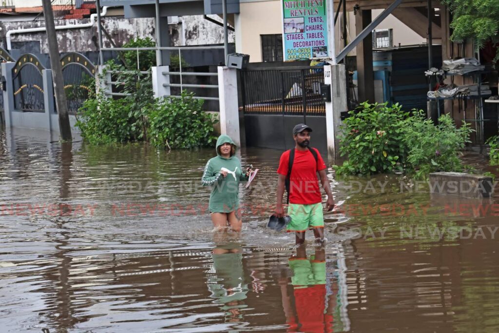
Meteorologist: Learn about weather patterns, heed Met Office warnings

METEOROLOGIST Gary Benjamin advised people to use available resources to learn about likely patterns, talking to Newsday on November 13, the day after massive flooding in south Trinidad. People should prepare before time, he said, using the TT Met Office's five-day forecasts and its robust suite of information.
He also advised people to heed Met Office warnings about thunderstorms, even if a yellow-level alert was not issued.
"We must understand the area we live in – if it is prone to flooding or landslips – and prepare for that before time.
"They should be that much more prepared to respond to the weather, like in cases that happened yesterday."
While saying November has always had a lot of rainfall, he said the way the rain was falling had changed over the years, to fall as very intense, short, sharp bursts.
"November is a pretty rainy month. It is the rainy season. This type of weather is expected."
He blamed current rain in TT on features including a tropical wave (an elongated area of low pressure) and the Inter Tropical Convergence Zone (ITCZ), a band of clouds, showers and occasional thunderstorms encircling the equator.
"With that line of moisture and surface convergence (when cold air moves in to replace warm air, in a low-pressure system) associated with the ITCZ, sometimes especially around this time, there would be different reasons for perturbation (change) in the flow, causing the ITCZ to be modulated sometimes.
"Therefore, we would get this kind of thunderstorm activity."
He said alongside the convergence, plentiful sunshine would have added heating to the mix of dynamics to result in lifting (the upward movement of air).
"The thunderstorm activity at this time of the year, associated with low-level convergence, associated with local dynamics, is nothing out of the ordinary."
Newsday asked how this year's rainfall compared to past years.
Benjamin said, "From time to time you will have years with different types of rainfall happening.
"This year in particular, for most of the year, we did not have the length of rainfall falling over a longer period of time, but the convective activity has happened in shorter powerful bursts, and thunderstorms occurring.
"Within the past couple of days we have been having that and of course the equatorial convergence associated with the ITCZ."
While saying rainfall patterns varied from year to year, he said current patterns were nothing out of the ordinary.
"Everybody lives with climate change, but climate change is a large average. Yes, we are seeing changes in the weather as far as the averages – the hot days and the type of rainfall activity – but for any one incident of rainfall from year to year, we cannot just attribute it to climate change, unless it is very spectacular.
"I am seeing spectacular rainfall events and things like that in different parts of the world, even the regular thunderstorms we have been having."
Saying thunderstorms are building blocks for all convective weather systems, he said even if they occurred alone as micro-events, they can have devastating effects on villages.
"We may have one powerful thunderstorm causing everyone in Trinidad and Tobago to be alert and scampering because of the flooding. That may just be a singular and micro-scale piece of the whole synoptics."
He said even single thunderstorms seen in the past few days were powerful enough – with their lightning and downdraught (which he said could reach storm force) – to cause the type of flooding seen on November 12. Benjamin said climate change affected not only rainfall patterns but also droughts which might become worse.
He said in 2020 he wrote a paper, based on his experiences over the years, about convergence at Trinidad's west coast.
"I would have seen certain effects of how those things were forming in the western areas over Port of Spain and west Trinidad.
"I would have written that paper because I am studying the effects of short, sharp weather – very concerning weather – over the years."
He said previously TT had rainfall from stratified clouds – thought to be a steady drizzle – but nowadays rain often fell as short, sharp bursts, in thunderstorms, attributed to convective activity.
"This is the type of thing we may expect from climate change, the warming of the climate."

Comments
"Meteorologist: Learn about weather patterns, heed Met Office warnings"