
TEMA: Tobago may need international help after Beryl
THE Tobago Emergency Management Agency (TEMA) warned on June 30 that the island would more than likely require international help to rehabilitate itself after the passage of Hurricane Beryl.
Beryl was expected to hit islands in the southern windwards – Tobago, Grenada, St Vincent and Barbados – as a category four hurricane around midnight.
The Trinidad and Tobago Met Office said in a release around noon on June 30 that Beryl had been upgraded to a category four hurricane.
Around 8 am on June 30, the office announced that Tobago had been put on hurricane warning.
It said it was closely monitoring the hurricane as it moved across the Tropical Atlantic. At that time, it said the system was located near 10.6 degrees N latitude 53.9 degrees W longitude, approximately 740km east of Tobago.
But Beryl, packing winds of more than 130km/hr, has intensified and there is a strong possibility that the system may hit Tobago as a category five hurricane.
During a news conference at Fairfield Complex, Bacolet, hosted by THA Chief Secretary Farley Augustine, TEMA director Allan Stewart said Beryl’s impact on the island could be catastrophic.
“This event started as a category three event, which means that it exceeds the capacity of the Tobago House of Assembly. It also will exceed the capacity of the national government and therefore, international relief will become an imperative,” he said.
Stewart said Tobagonians must prepare themselves for a 72-hour ordeal, in the first instance.
“Given that scenario, it means therefore that you have to pay attention to how you manage your resources going forward and how you move resources to the island.”
Alluding to his experiences in managing the effects of the February 7 oil spill, he said the challenges of moving resources to the island are real.
Stewart said during discussions with CEO of the Office of Disaster Preparedness and Management Rodney Smart, they spoke about pre-positioning not just equipment but human resources.
“We expect that through the meetings that were held at executive level in Port of Spain, that we will see troops from the engineering battalion arriving at the first hour that we are able to make a safe sailing to Tobago to provide relief.
“However, based on our incident action plan, one of the key objectives is to do rapid assessment and also to provide relief where it is necessary. We understand exactly what is the magnitude of this impact and, therefore, we ask persons to take this extremely seriously.”
He said many people of this generation have never experienced such a natural phenomenon.
Earlier, Carolyn De Coteau, meteorological officer 2, said Tobago was poised for a direct hit.
“Just after midday, Hurricane Beryl became a category four hurricane, which means that we can expect maximum sustained winds of up to 215km/h,” she said, adding that before it makes landfall, the island would experience gust fronts and strong winds.
The system’s impact on Tobago, De Coteau said, would be characterised by significant rainfall, storm surges and strong winds.
“In hilly areas, the wind tends to be about 30-40 per cent higher than in areas that are low-lying. So persons in those areas should take extra precaution to secure whatever to ensure that things don’t become projectiles.”
She said Beryl is likely to produce 75-150mm of rainfall.
“Based on this, we can expect the possibility of flooding is very high. We are at an orange level. It is a significant and expected impact of this system for rainfall. Winds, we expect tropical-storm-strength winds to affect Tobago and that will be up to 90 per cent to 100 per cent of tropical-storm-force winds.”
At the time of the briefing, De Coteau said the hurricane was south of Tobago and moving eastward.
“The system is actually moving slightly south of the forecast path, which means that more than likely we are getting a direct hit from the system.
"I don’t mean to alarm you but I want people to take this seriously, because there are concerns that people are not preparing enough.
“I am telling you that based on the fact that the system is to the south of us and most of the stronger winds is to the north of the system, we are 11.9 degrees north; the system is between 10. 8 and 10.9 degrees north. So that is a whole degree latitude south of us.
"So as it slowly veers north, that means that we are going to be in that area of strength and strong winds and rainfall.”
Saying storm surges will occur, she urged fishermen to secure their boats, as there are likely to be three-four feet of tides.
“We are in the path of this storm. We have to prepare for this category four hurricane, which may even strengthen to a category five before it reaches us, at the rate it is going.”
Tobago on full alert
Stewart said the island is on full alert and all shelters will be open to accommodate distressed Tobagonians.
But he noted that, given the force of the system, utilities will be severely affected, as well as houses. He said areas such as Kendal, Argyle and Charlotteville could be severely affected by storm surges.
Stewart said Tobago is expected to get about 150mm of rainfall and there will be flash flooding and slope instability.
“We are talking about landslides that will bring along with (them) trees, pulling down utility lines and therefore, throughout the island of Tobago, based on the strength of this system, we can see widespread damage.”
He urged shelter managers to exercise empathy.
Declaring that Tobago was in a state of absolute emergency, Augustine said all schools, public and private, will be closed on July 1 and will remain so until further notice.
Only essential THA staff, including road maintenance crew, public health teams, CEPEP and URP, will be required to go out to work on July 1.
Some workers in the Division of Agriculture, responsible for farms, will also be called out in the hours post-Beryl to assess private farms and land holdings and minimise loss at government farms.
He said THA property managers are also expected out, today, not to work but to assess damage to state property.
Augustine said regular services have been suspended at health centres.
“There will be no elective surgeries, no appointments at our hospitals or at our health centres.
"Instead, the Roxborough Hospital and Scarborough General Hospital will be operating their accident and emergency (departments) and that service will be targeting any mishaps that might happen during or after the hurricane. So Roxborough and Scarborough Hospital, they are our main points when it comes to medical care at this time and going forward.”
Patients should not try to honour their regular appointments, he added.
“From now going forward, we are treating with accidents and emergencies.”
Augustine urged Tobagonians to be their brother’s keepers during this trying time in the island’s history.
Minority Leader Kelvon Morris also called for unity.
“This is a time for our community to come together, support one another and take all necessary precautions to minimise the impact of the hurricane. I strongly urge everyone who is able to stand ready to volunteer your services and share your resources as we continue our preparations,” he said in a post on his Facebook page.
Uneasy calm
On June 30, there was an uneasy calm across the island as people contemplated the implications of a hurricane.
“I not taking this thing for granted,” one man said at TLH Plaza, Scarborough.
“Somebody told me that in 1964 when we had Hurricane Flora, the place was quiet just so.”
In fact Hurricane Flora hit the island in 1963.
Unlike Saturday, when news of Beryl broke, there was panic-buying at several major groceries.
One shopper, who visited the PennySavers supermarket in Carnbee, said she had to leave because it was too crowded.
“If you see people there. People started panic-buying. But I already have candles in my house. I just have to get a few canned items and some water,” the woman said.
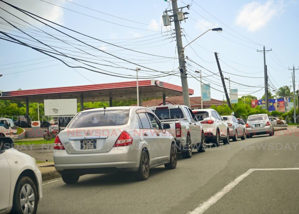
There were also long lines at gas stations.
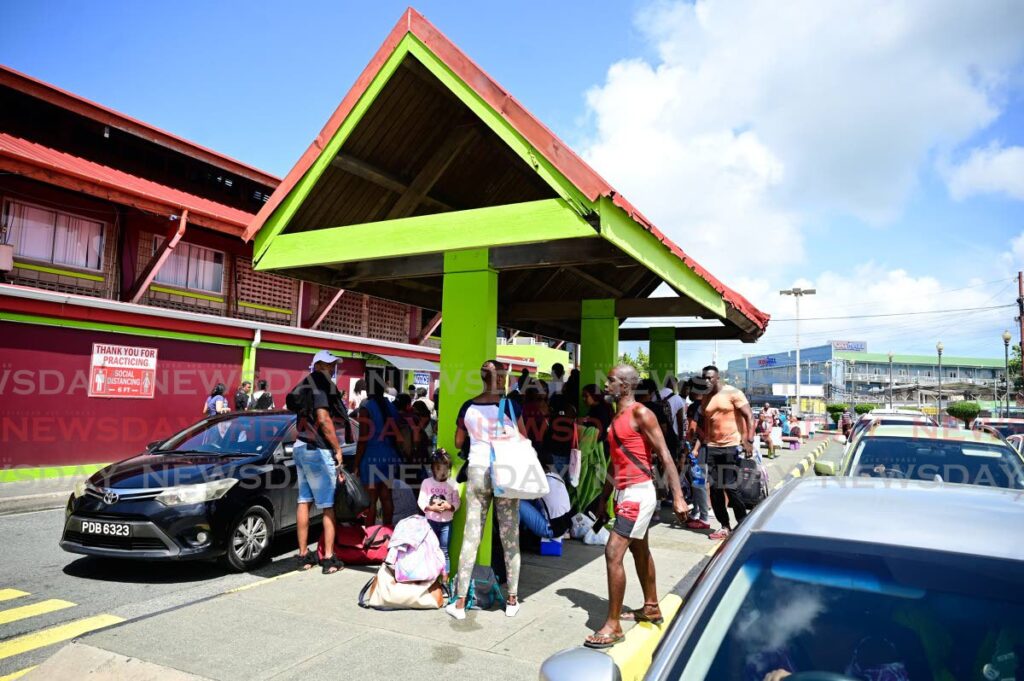
However, there were some tense moments at the Scarborough port early on Sunday as scores of passengers tried to get to Trinidad onboard the APT James. But the situation was cleared up by around 8.30am.
The Trinidad and Tobago Inter-Island Transportation Co Ltd, in a release on June 29, said all sailings of the passenger ferries on July 1 would be cancelled.
However, it said for all passengers who wished to return on Sunday, an additional sailing was scheduled at 1.30pm. Passengers would have be accommodated on other sailings depending on the availability of space.
The MV Cabo Star sailed from Port of Spain on Sunday as scheduled, but was expected to leave Tobago at 9pm instead of 11pm.
Finance Minister Colm Imbert tweeted on June 30, that boats from islands that are under threat from Beryl are heading to Trinidad for shelter.
“With dangerous Hurricane Beryl heading for Barbados, St Vincent, Grenada and Tobago, there is an amazing influx of boats (close to 100 so far) coming down through the first Boca to Trinidad to shelter from the storm. The Government is preparing to accommodate them,” he wrote.
Comments
"TEMA: Tobago may need international help after Beryl"