Trinidad and Tobago’s rocks and their influence on our various sectors

DR ADRIAN TUITT
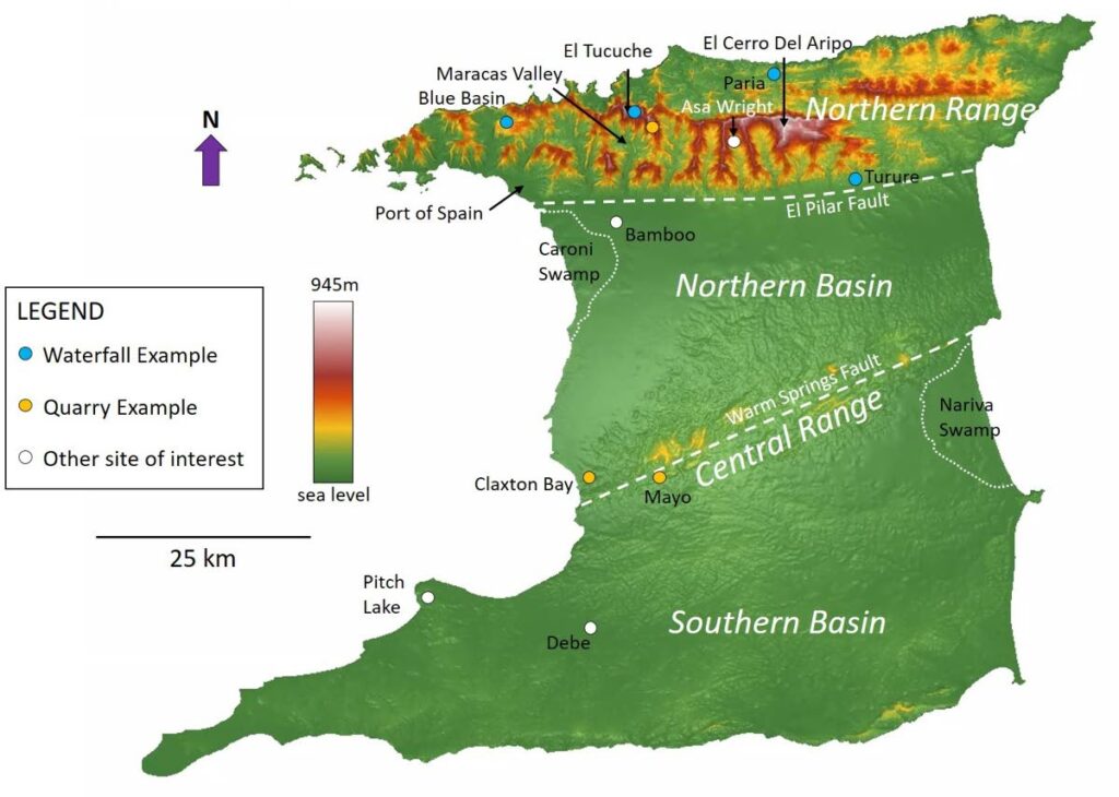
Around 8,000 years ago the Amerindians came to the shores of Trinidad and were greeted by a verdant landscape teeming with life. It was apparent even back then that the topography on the island varies from north to south. Indeed, the Northern Range, Northern Basin, Central Range and Southern Basin have a unique tectonic history that has affected not only the surface topography, but the structure of the underlying rock.
The geological history of any country can give rise to different rocks. Rocks can be categorised into three groups – sedimentary, igneous and metamorphic.
Sedimentary rocks are formed as the result of the deposit of grains or the precipitation of minerals. Sandstone, for example, is formed when quartz grains are deposited in terrestrial or marine environments. These grains are eventually compacted upon burial to form rock. Igneous rocks, however, are formed by the cooling of magma. Molten magma is formed by the melting of rock within the earth. When the magma is cooled, different igneous rocks such as basalt or granite are formed, depending on the magma’s chemistry and the cooling rate. Metamorphic rock is formed when pre-existing rocks undergo changes due to an increase in pressure or temperature. Limestone, for example, is a sedimentary rock formed by the deposition or precipitation of calcium carbonate. When limestone undergoes an increase in pressure, marble is formed.
In Trinidad, the Northern Range consists of metamorphic rocks, with a small section around San Souci consisting of igneous rock. Sedimentary rock makes up the majority of the land mass that is Trinidad and is found directly south of the Northern Range in the Northern Basin, Central Range and the Southern Basin.
The Northern Range is the highest terrain on the island and consists of quartzites (metamorphosed sandstone), phyllites (metamorphosed shale) and low-grade marble (metamorphosed limestone). In the Late Jurassic to Cretaceous time (about 150- 65 million years ago), sediments were deposited on the ocean floor. These sediments were uplifted and metamorphosed from the Early Oligocene (around 40 million years ago) as the Caribbean Plate collided with the South American plate, the boundary of which was marked by the El Pilar Fault.
The advancing orogenic belt placed a weight on the South American crust to the south, resulting in subsidence in the Southern Basin. Furthermore, as the orogenic belt eroded, the eroded sediments were deposited into the Southern Basin until Mid Miocene time (around 12 million years ago).
In the Mid Miocene, the plate boundary between the Caribbean and South American plate changed from one of convergence (collisional) to strike-slip (plates slide past each other). The strike-slip fault developed in the area of the Central Range and is called the Warms Springs Fault.

The orientation of the Warms Spring Fault facilitated compression and the Central Range was formed by folding and uplift. The compression at the Central Range translated into the Southern Basin, resulting in a series of folds propagated by faults in the subsurface.
Further to the west (western Gulf of Paria) the orientation of the strike-slip fault resulted in extension and subsidence in the Gulf of Paria and Northern Basin in the Mid Miocene.
At this time, sediments continued to come predominantly from the north into the Northern Basin and Gulf of Paria.
However, in the Southern Basin, sediments were predominantly from the Orinoco Delta, which transported sediment to southern Trinidad from Mid Miocene time.
The topography across the island has undoubtedly been affected by its geological history. The terrain and the underlying geology is of socio-economic importance to Trinidad.
The Northern Range is covered in dense tropical rainforest. This terrain receives the most rainfall on the island. The high vegetation and thick leaf litter allow water to trickle down slowly to the bedrock via a series of lineaments such as fractures and faults. This is essential for the recharge of groundwater aquifers, which are a source of potable water in Trinidad.
The Northern Range is also important as a habitat for flora and fauna, providing an avenue for eco-tourism. This terrain contains the highest peaks of El Cerro Del Aripo (945 metres) and El Tucuche (936 metres) and is the site of many waterfalls, such as Blue Basin, Maracas, Paria and Turure falls.
It is thus little wonder that the Northern Range contains a number of hiking trails. In Macqueripe Bay, activities such as ziplining and mountain biking owe their existence to the Northern Range terrain.
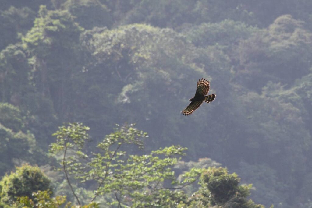
Furthermore, the rich fauna is also enjoyed by visitors. The Asa Wright Nature Centre, for example, lies in the heart of the Northern Range in Arima and is one of the top birdwatching spots in the Caribbean.
Subsidence in the Northern Basin has also encouraged eco-tourism. The flat plains of the Northern Basin have facilitated the formation of the Caroni Swamp. The terrain is flat and expansive enough for continued flooding by both sea and river water. The swamp is the main habitat for the scarlet ibis, the national bird of Trinidad. At dawn and dusk the sight of bright red against the light blue sky is evident, attracting many visitors to the swamp.
The Northern Basin has also played a major role in agriculture. A large proportion of the sugar cane plantations were located on the fertile flat lands of the Northern Basin (Caroni). This cultivation was easily serviced by railway lines, which provided a major form of transport up to the late 1960s. Although final closure of the sugar-cane industry took place in 2003, the Caroni Plain (western section of the Northern Basin) remains a main food basket on the island for crops such as rice.

The sedimentary rocks of the Southern Basin have been instrumental to the oil and gas industry. These rocks are a critical aspect in the formation of oil and gas. A source rock, such as shale rich in organic matter, produces oil and gas when buried under anoxic (very little oxygen) conditions. The oil and gas (collectively called hydrocarbons) migrate into the pore spaces of rocks (reservoirs) such as a sandstone. To prevent the migration of hydrocarbons outside the reservoir an impermeable rock such as a shale is needed as a seal.
In the Southern Basin, the source rock is the Naparima Hill Formation, which makes up the San Fernando Hill. Reservoir Rocks include the Herrera sands (sourced from the northern orogenic belt) and the Cruse and Forest sandstones (derived from the Orinoco Delta), which are capped by shale seals.
Oil and gas exports contribute a significant portion of government revenues. In addition, gas is used to generate the nation’s electricity and is also used in the petrochemical industry at Point Lisas to make products such as methanol and ammonia.
However, most of this gas is supplied from offshore fields.
The lack of seals in the Southern Basin results in oil seepage to the surface and the largest of these seepages is the Pitch Lake. Here, oil exposed to the surface has been degraded by bacteria to form asphalt. The First Peoples used the asphalt to waterproof their canoes, and today the asphalt is an important input to road construction not only in Trinidad, but all over the world. The Pitch Lake also attracts many visitors to La Brea.
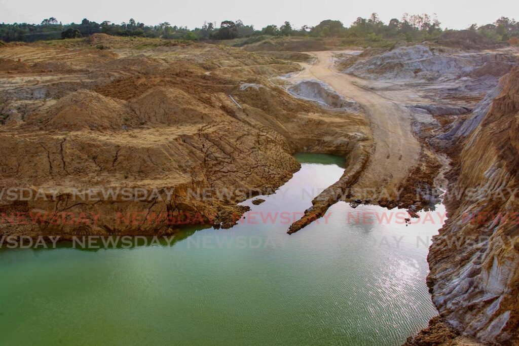
In addition to extracting resources from rocks, we have also extracted rocks themselves in quarries. These rocks have been used in road construction, such as quartzite from Maracas Valley in the Northern Range. In the Central Range rocks have also been quarried for building construction (such as sandstone from Sum Sum Hill Formation in Claxton Bay) and for cement manufacturing (limestone from the Brasso Formation in Mayo).
As we continue extracting value from our rocks, it is important that this is done sustainably. Quarrying can lead to the destruction of the watersheds and wildlife habitats. It is, therefore, important for quarries to be reforested after use to minimise the impact on the environment. The IAMovement, for example, is an NGO that has introduced the vetiver system to communities to increase soil integrity. The vetiver system can increase the absorption and infiltration of rainfall, reduce surface runoff, and mitigate against flooding.
The terrain type has been a major factor in natural hazards. Low-lying areas in Trinidad are prone to flooding. These include the Bamboo Settlement in the Northern Basin and the Debe area in the Southern Basin. It is imperative that these areas have proper drainage to take away the excessive runoff brought on by extensive rainfall.
Areas that are sloping, such as hills in the Northern Range, Central Range and Southern Basin, are affected by landslides. The underlying bedrock in these areas is covered by soil rich in clay. Some clays, such as montmorillonite, expand when wet. Thus slopes consisting of montmorillonite are prone to failure during rainfall, resulting in landslides. The vetiver system can also stabilise slopes in these areas especially on slopes devoid of vegetation as a result of building and road construction.
The terrain in Trinidad has been shaped by tectonic events affecting both the topography and subsurface rock. The Northern and Central Range are relative highs created by uplift due to compression. The Northern Basin subsided as a result of tectonic extension to create a flat terrain, while the Southern Basin consists of low-lying hills, as it first underwent subsidence before undergoing compression. The surface terrain on the island has determined land use, while the subsurface bedrock has also provided valuable resources.
According to the Ministry of Foreign and Caricom Affairs, the red in the national flag represents the vitality of the land and its peoples. Indeed, our land continues to breathe life into our economy and it is important that we recognise this and advocate for its protection.
Dr Adrian Tuitt is a recipient of a national open scholarship and is the past president of the Geological Society of TT. He has a PhD in structural geology from the University of Edinburgh, Scotland, and did post-doctoral research at the University of Adelaide, South Australia. He has over ten years of experience in the oil and gas industry and works as a structural geologist at Heritage Petroleum.
Add the Geological Society of TT on Facebook, Instagram, LinkedIn and check out https://thegstt.org/

Comments
"Trinidad and Tobago’s rocks and their influence on our various sectors"