
Rising sea levels and the billions in damage facing Trinidad and Tobago
Global mean sea level is expected to rise by at least 1.1 metres by 2100. UNDP and OECS estimates that this would permanently displace at least 110,000 people in Caricom countries and inundate over 90 per cent of the region’s commercial ports. By 2050, the costs associated with rising sea level is projected to cost Caricom nations up to US$60 billion in damage, of which US$7 billion would be for TT.
As a small island state, TT is particularly susceptible to any change in sea conditions, which can have catastrophic impacts on our islands and their populations. There are many stories around the country of the existence of streetlights, houses, even playfields that are now submerged. Trinidad’s south-west peninsula and south-east coast have probably been the most visibly affected by coastal erosion. If one were to look at maps of TT’s coastline from the 1980s, especially in the Mayaro/Manzanilla area, we would be shocked by how far the beaches have moved inland.
How can sea level rise?
Climate change is currently causing a rise in global temperatures, which in turn is accelerating the rate of melting of glaciers around the world. Waters released by melting glaciers flow into the oceans causing sea levels to slowly rise. If all the glaciers melted, it is estimated that sea level could rise by as much as 60 metres (200 ft) above current levels. This is called absolute sea-level rise and is different from relative sea-level rise. Land can subside or sink by compaction of soft sediments over time as in swampy areas and reclaimed land. Tectonic activity due to moving plates can also result in relative sea-level differences. Over TT’s geological history, tectonics has been the dominant cause of sea-level changes.
John Agard, a marine biologist at UWI, indicated that 20 years ago, measurements of sea level at the Port of Spain, Point Fortin, Galeota, and Scarborough harbours showed that the rate of sea-level rise was 1.6 mm per year. By 2019, this increased to 3.0 mm per year.
If sea-level rises by five metres, what would happen?
Three per cent of Trinidad's total area would be submerged. In Tobago, most of the impact will be in the Buccoo, Bon Accord, and Lowlands areas. The primary impact would be the drowning of low-lying coastal areas, including the Caroni Swamp and areas extending towards Point Lisas, the Nariva Swamp, and most of the Oropouche River drainage basin in the Debe area.
Our largest urban centre, Port of Spain, and its suburbs, which were reclaimed from the swamps and sea would also be severely impacted. Most of our industrial infrastructure, ports, and power generation facilities at Point Lisas, the Atlantic LNG plant at Point Fortin, the refinery at Pointe-a-Pierre, and Trinidad Cement Ltd’s plant at Claxton Bay would be submerged. This would result in the permanent displacement of tens of thousands, unusable land and property, complete disruption to our imports and exports, destruction of core parts of the energy sector and of course, the economic impact would be incalculable.
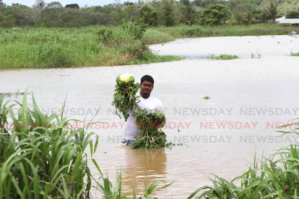
Some effects can already be seen in Port of Spain, as flooding often occurs after heavy rainfall, especially during high tides. This happens when the rainwater is hindered from reaching the sea through drainage systems already flooded by the tide. The intrusion of saltwater up the rivers into farming communities will negatively impact agriculture due to loss of farmland and the inability of crops to grow in saline soils. The Oropouche Lagoon is an area where this is already taking place, aided by non-functioning sluice gates that were designed to prevent the entry of saltwater.
Potable water availability is threatened by saltwater intrusion. Our freshwater artesian aquifers are generally recharged by rainfall falling onto and percolating into sandy layers. Most of these aquifers are in contact with the sea and as a result, seawater fills these sands close to the coast. Rising sea levels will increase the rate of this intrusion, reducing the amount of freshwater available.
Rising sea levels will also result in more of the coastline being exposed to the breaking of waves, erosion, and associated transportation of sediments along the coastline. The processes of coastal erosion are continually active and are only noticed when it involves the destruction of property and removal of areas along the coast. Increasing water depths allows more breaking waves energy to reach the shoreline accelerating erosion, which is commonly seen during the dry season along most of our beaches. This erosion can cause roads to collapse – as at the mouth of the Nariva River on the east coast – cutting off communities, or collapse and destruction of houses, as in Cedros.
Coastal flooding is another consequence of rising rea levels. Commuters who use the Mosquito Creek dread the months of October and November. During this period, the high tides periodically flood the roadway making them temporarily impassible. Some brave individuals may choose to drive through the saltwater, which can cause vehicles to stall and become flooded, and rust and damage vehicles. Currently, as part of the Point Fortin highway project, the roadway is being completely rebuilt at a cost of hundreds of millions of scarce dollars, using innovative construction techniques to raise the roadway well above the current sea level.
Our thinking about infrastructural design, port activity, agriculture, housing and economic activity has to change fundamentally to be prepared for the unavoidable sea level changes over the coming decades.
This article was sumbitted by the Geological Society of TT, a professional and technical organisation for geologists, other scientists, managers and individuals engaged in the fields of hydrocarbon exploration, academia, volcanology, seismology, earthquake engineering, environmental geology, geological engineering and the exploration and development of non-petroleum mineral resources.
Comments
"Rising sea levels and the billions in damage facing Trinidad and Tobago"