
Reading a satellite weather map
In 2022 Trinidad and Tobago and other Windward islands experienced very severe weather with heavy rains and extreme flooding. You would have seen in the newspapers how much damage there was to homes and property. Rivers overflowed, roofs blew off buildings and there were many landslides and collapsed roadways.
Many days later, rivers were still overflowing and houses and yards were still flooded.
You can learn how to tell when a bad weather system will affect us if you learn to read an online weather satellite map.
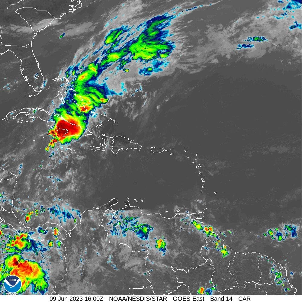
Search for the site StormCarib.com on your computer. Outline maps of the Caribbean will appear along with other information.
On this site, during the hurricane season between June and November, hourly updates are given on current weather conditions. These updates will include information on tropical waves, tropical depressions, storms and hurricanes to keep you alert to their progress. The maps will show the direction a tropical depression or hurricane is likely to take.

Usually storms originate off the western coast of Africa and travel from east to west across the warm Atlantic ocean, generally toward the Caribbean or north in the Atlantic ocean.
Click on the Storm Carib page on more satellite imagery.
Scroll down to find several more maps of the region showing different aspects of the current weather conditions, including one that shows potential systems, tropical waves, depressions and any other current, active weather systems. These maps give details on wind and heat, and show Sahara dust, ocean temperatures etc.
These outline maps include not just the Caribbean islands, but the western coast of Africa, northern South America, southern US and Central America.
Visit the site daily for updates on the progress of weather systems. Perhaps in time you will also be able to forecast the direction a storm might take.
The site also gives the names of potential hurricanes.
At all times of the year, StormCarib.com gives information and warnings about ocean conditions including extreme wave and wind action, and how these might affect the islands, earthquakes and other aspects of weather and climate. There are links in this network, to other sites that are helpful.
StormCarib.com is hosted by Gert van Dijken and Dave McDermott with input from several weather watchers across the Caribbean islands. Read on to find out how you can become a contributor to this site.
Some easy questions for you
1.When is the hurricane season in the Caribbean?
2. Where do storms generally originate?
3. What is a satellite?
4. What kind of information will you find on a weather satellite site?
5. How is this information useful?
6. Are the terms "weather" and "climate" the same?
Comments
"Reading a satellite weather map"