
Weather alert still in place: warning of rivers overflowing
AMONG hugely varying reports of overnight weather patterns across Trinidad and Tobago, the Met Office reissued its yellow alert on Thursday.
This time it added a riverine alert, after reports of at least one river bursting its banks in places.
Individuals interviewed by Newsday said weather in their areas ranged from no activity to heavy rains and winds.
In Curepe no rain fell and there were no high winds nor anything adverse. Port of Spain had just a light drizzle but no high winds. Chaguanas experienced short periods of very heavy rainfall, on and off, for about an hour from about 9-10 pm.
"It was strong, short bursts of rain, but not persistent," one central Trinidad resident reported.
A Diego Martin resident said the wind had started picking up after 8 pm.
"The wind started beating and trees started breaking. We had a temporary power outage for about two hours but it came back at about 10 pm. We had a couple of downpours." He said very high winds blew off some sheets of galvanise from roofs and broke some trees on nearby hills.
A San Fernando resident reported, "The rain was consistent, with lulls in between, but not heavy. There were no strong winds nor thunder and lightning. There was no flooding as San Fernando is hilly, allowing a quick run-off of rainwater."
She had heard of heavy rain in deep south areas like Point Fortin, plus flooding in Penal and Claxton Bay.
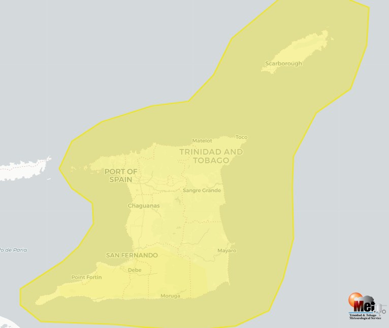
The Met Office, in its 11 am update on Thursday, warned of a high chance of showers and thunderstorms until the evening, with floods and landslips likely.
It forecast: "Mostly cloudy with showers and the 70 per cent (high) chance of thunderstorm activity over varying areas. Gradual improvement likely during the evening/ night, becoming mostly settled despite few lingering showers and the 30 per cent (low) chance of the isolated thunderstorm. Adverse weather alert No 3 (yellow level) including riverine flood alert No 1 in effect!
The alert said, "Showers and thunderstorms continue to affect Trinidad and Tobago with most of the activity for today expected over marine areas.
"Some heavy overland showers favouring the afternoon period, can still lead to street and/or flash flood events and landslips. Localised flooding can be exacerbated."
The alert said a riverine flood alert was in effect for south Trinidad.
"Impacts can include reduced access to areas due to flooding, with some damage to property.
"Tree branches and loose objects can be displaced during strong winds. Flooding, landslips and waterlogged soils can lead to infrastructure damage in areas so prone."
The Met Office advised people to monitor weather conditions and updates from official sources, such as www.odpm.gov.tt.
"Avoid flooded areas and exercise precaution in areas with land slippage. Follow the instructions of government officials."
The Ministry of Rural Affairs and Local Government, in a river level advisory tweeted at 9.30 am on Thursday, noted that river levels were currently rising, given high tide due at 2.33 pm and low tide only due at 8.22 pm.
It declared, "The South Oropouche River has breached its banks in some parts with water spilling into some communities in South Trinidad. We urge the public to take caution."
The ministry deemed that river to be at 82 per cent capacity.
Next worst was the Caroni River at El Carmen, at 76 per cent capacity, and at Bamboo at 67 per cent capacity.
The other rivers listed were Arouca (38 per cent), North Oropouche at Todds Road (36 per cent), Caparo (35 per cent), and Aripo (15 per cent).
A ministry tweet soon after declared, "Other major rivers are contained at this time and are being closely monitored.
"Please be advised that high tides will result in slower water run-off. Affected communities are urged to call relevant disaster management units."
The Office of Disaster Preparedness and Management (ODPM), in a 9.30 am summary of incident reports, mentioned the impact of the weather in five out of its six regions of TT, based on reports from the respective municipal corporation, with only the north central region reporting no incidents.
In northwest Trinidad there were reports of a partially blown-off roof at Monchelleua Hill, Paramin, Maraval; no electricity at Sunset Drive, Bagatelle Road, Diego Martin, due to a sheet of galvanize cutting the line; and a tree falling onto the road and pulling down power lines at Saut D'Eau Road, Morne Cyril, Paramin.
In south central Trinidad, the ODPM reported street flooding along the M1 Tasker Road and the M2 Ring Road junction, near Chiney’s Wrecking Service, plus residential flooding at Rig Road North, Claxton Bay. From southwest Trinidad came reports of residential flooding at Suchit Trace, Penal and Siparia Road, Fyzabad.
In centra Trinidad, the ODPM reported residential flooding at Caratal Road, Cumuto; a damaged roof due to high winds at Bestry Extension, Serrier Circular, Guayaguayare; a blown off roof at North Manzanilla; and a fallen tree blocking access to a house at El Reposo Main Road, Sangre Grande.
From Tobago came reports of a fallen tree blocking the road on the Roxborough-Bloody Bay link road near Roxborough Secondary School; and a tree falling on a house at Mt St George.
Comments
"Weather alert still in place: warning of rivers overflowing"