
Rains, floods lash Sangre Grande
As Trinidad and Tobago endured the effects of a yellow-level adverse weather event on Tuesday, Sangre Grande was the most affected area in North and Central Trinidad.
A representative of the Disaster Management Unit of the Sangre Grande Regional Corporation said flooding was reported in Ojoe Road, Foster Road, Picton Road, Coalmine Road, Ramdass Street, Naranjan Street, and Oropouche Road.
“Several communities would have been affected, so we’re doing our assessment at this present time. We have no reports of injuries or fatalities.”
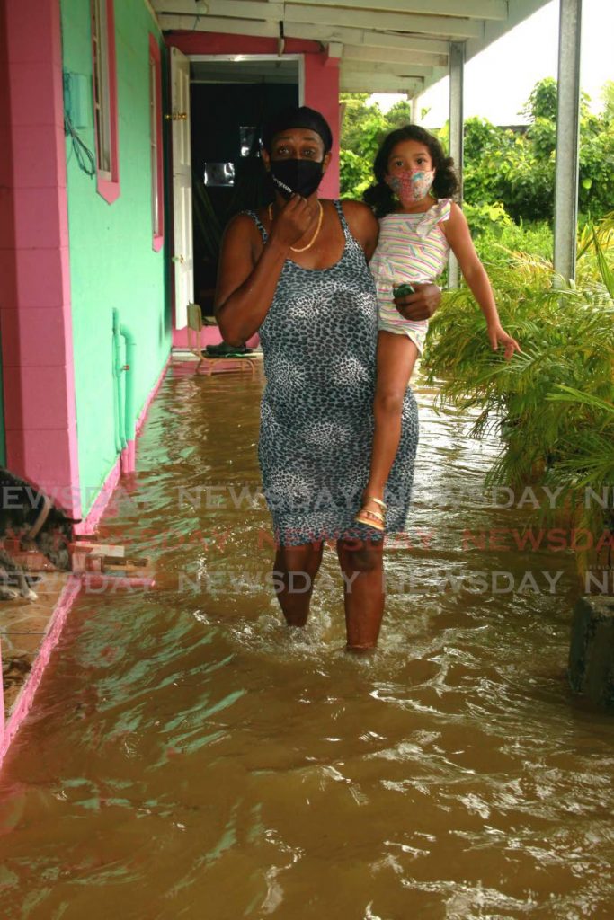
Resident Lystra Maloney, who lives on Coalmine Road, said flooding in her community was a regular occurrence whenever there was a heavy downpour.
“We told them they did the drain outside too low, every time the slightest rainfall we get flood right through. They need to raise this drain, and then the neighbour across there, built a wall and all the water backs up and goes into my yard and the other neighbour’s yard and he’s out of the water now, it’s too much for us.
"My bed, everything in water down there, I can’t do nothing, just stand still. All my mattress everything wet. I couldn’t go out to work this morning either. The last time (in 2018) I lost everything in my house, my husband dead and gone and we never get back anything. I had to go all over to get the cheque done in my name, and it was only $6,500, which didn’t help for the amount of things I lost in my home.”
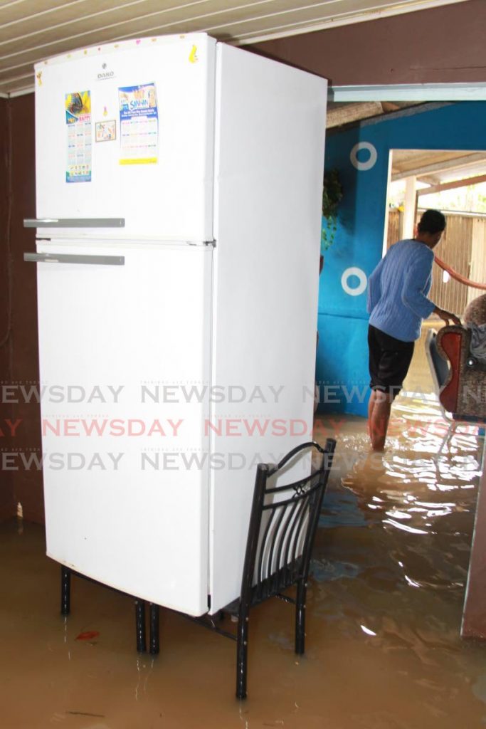
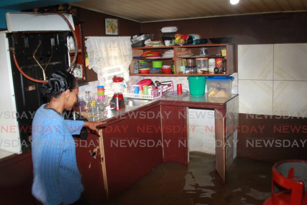
Naranjan Trace resident Jenny Charles said she, her brother and sister-in-law and other family members had been flooded out. Her feet could be heard sloshing through the water in her house as she spoke to Newsday on the telephone.
“We have everything raised inside the house. My whole house is flooded, my family who lives next door is flooded out, my nephew is swimming downstairs. I have a shop and the water took a fridge and freezer already, there’s nothing I can do about it. The councillor for Sangre Grande visited us and told us to go to the Disaster Management Unit tomorrow. We’re not sure how high the water will go again because it’s still raining. It’s a loss again like what we went through in 2018. It’s very hurtful to know what we’re going through.”
Picton Road resident Danielle Boodoo-Fortune said the area was totally flooded.
“Picton Road and the surrounding streets are impassable, and there are no signs of rain stopping here.”
Attempts to reach Toco/Sangre Grande MP Roger Monroe were not successful.
When contacted on Tuesday afternoon, the Diego Martin Regional Corporation, Arima Borough Corporation, and the Chaguanas Borough Corporation said there were no reports of flooding. Attempts to reach the Port of Spain City Corporation, the San Juan/Laventille Regional Corporation and the Tunapuna/Piarco Regional Corporation were unsuccessful.

The yellow-level adverse weather event is forecast to last until Wednesday at 6 pm, the Met Office said.
“Although periods of light rain are expected on Tuesday, the intensity of the rainfall is forecast to increase during the early morning on Wednesday.
"There is a medium chance of isolated thunderstorms but a high potential for intermittent, moderate to heavy rainfall to continue throughout the day. This increases the risk for localised flooding in areas so prone and can further exacerbate impacts from Tuesday’s rainfall activity.
The Met Office said there was the likelihood that tributaries and smaller river courses could overflow their banks and landslips might occur in areas so prone.
It added, "Gusty winds in excess of 45 km/hr may accommodate heavy showers or thunderstorms.”
Comments
"Rains, floods lash Sangre Grande"