
Delivering signs for nature sites
RAYNALDO PHILLIPS
Food and Agriculture Organization
VISITORS and even local sightseers can at times find themselves lost or uncertain about the location, name or information about a nature site when traversing the country.
For the past four years, the United Nations’ Food and Agriculture Organization (FAO/UN), while contracted by the TT Government, has partnered with several forestry sector stakeholders to improve forest and protected area management; building public awareness and education has been a main mechanism.
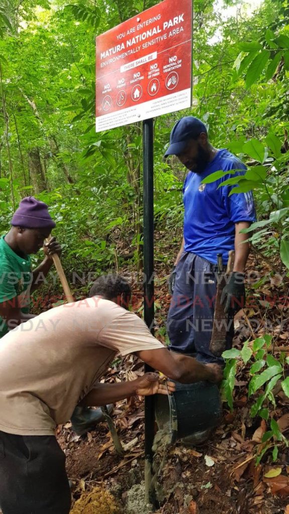
Six protected areas were selected to pilot these improvements and key studies were conducted. One of the early studies, the Knowledge, Attitudes and Practices Survey revealed that many people living near the forests have little or no awareness about these protected areas, said a media release from Food and Agriculture Organization (FAO). Based on this evidence, a key decision was made to prioritise the design and erection of signs at strategic locations in and around the Protected Areas (PAs).
Delivering the message
The sign designs were guided by varying considerations. They were designed with a purpose, to be informative to viewers on little known facts, educating and expanding on the values of the PA and its connection with people's lives. With a main focus on conservation, these signs also make a call to action and conscience, to cease adverse practises in PAs. These messages were kept clear, concise, correct, credible and comprehensive.
The strategic placement of signs was carefully considered. It was decided that the main signs be placed at major entry points to the PA, inform about the key assets of site, and educational signs positioned in the hubs of surrounding communities. Signs are to be introduced along key segments of the PA boundary where conflicts occur.

-
Recognising the importance of colour and its appeal to visual senses, the colour green predominated on main signs to maintain an eco-friendly vibe and nature-based perspective. Yellow, a bright and attractive colour, was used on educational signs, and red, was used on boundary signs, conveying a sense of urgency and danger.
Community involvement
The development of the signs has drawn from a community that extends beyond the boundaries of the PA and its local residents. This was accomplished by using a participatory stakeholder approach early in the process. Teams led by members of Subcommittees comprised of representatives of Government and non-Governmental organizations brainstormed the approach through the stages of determining needs, to designing and positioning in the field. This culture of cooperation is expected to continue with the maintenance of the signs.
Improving Forest and Protected Area Management in Trinidad and Tobago is a four-year project being implemented by the Food and Agriculture Organization of the United Nations for the TT Government. Funding was provided by the government, FAO/UN, the EU and the GEF. For more info: http://eppd-tt.blogspot.com/p/gef-improving-forest-and-protected-areas.html. To learn more about our local forest and protected areas, visit: https://protectedareastt.org.tt/
Comments
"Delivering signs for nature sites"