Great storms on the rise

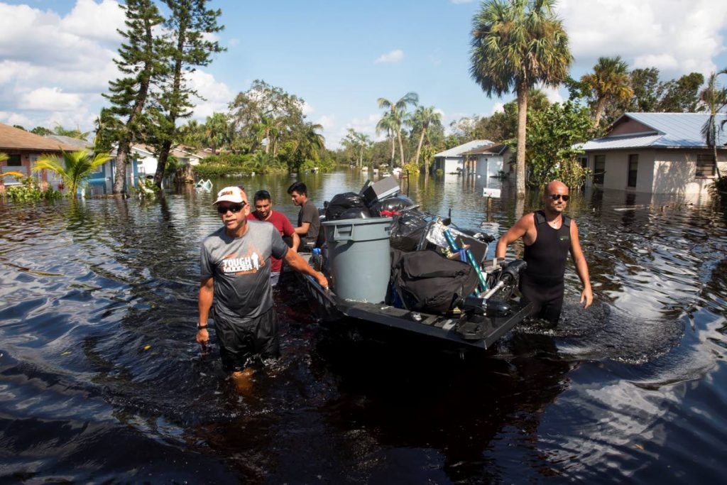
The strength and frequency of tropical cyclones in the North Atlantic Basin during the hurricane season this year has been a cause of concern and fear for many Caribbean islands and several coastal states in the United States.
Many were surprised by the recent, simultaneous appearance of three hurricanes along the North Atlantic Basin, especially so shortly after Hurricane Harvey. Then there was the unexpected strength of Hurricane Irma which was among the strongest Atlantic hurricanes ever observed.
Arlene Aaron-Morrison, climatologist with the Trinidad and Tobago Meteorological Service (TTMS), explained to Sunday Newsday that many different factors, including ocean warming and rising sea levels (symptoms of climate change), contribute to the increase in the strength of some of the storms the Atlantic had been experiencing.
“For years researchers have been speaking to changes such as extreme precipitation events over most of the mid-latitude land masses and over wet tropical regions will very likely become more intense and more frequent by the end of this century as global mean surface temperature increases.”
She also noted that Irma, Jose and Katia were not the first hurricanes to appear simultaneously, but that in September 2010, Igor, Julia and Karl followed similar paths although they were not as strong as the recent three.
TTMS climatologist Kenneth Kerr also told Sunday Newsday that Irma, Jose and Katia were not in the Atlantic Ocean at the same time but in the North Atlantic Basin, the hurricane developing region.
He stressed that one could not say climate change was the cause of Irma’s strength as the evidence was not conclusive. “We can’t say for sure that Irma was a direct result of climate change because it was one event. But if we have this thing occurring for a number of years consecutively then we could argue it is climate change.”
However he said, in general, climate change had contributed to stronger storms since there was a direct relation between sea surface temperatures and the intensity of tropical cyclones. “When you look at other basins and the other side of the Caribbean Sea, then the argument holds because there is evidence that suggests that these intense systems have been more frequent in recent times.”
“What the research and all the evidence is pointing to is that we expect the intense tropical cyclones to become more intense, and that there would be more frequent intense cyclones, not the general cyclones.”
Kerr explained that there were two main reasons why TT was usually spared from tropical storms. The first was because storms did not usually form very close to the equator and TT was approximately ten degrees north of the equator. That meant storms usually formed north of the country. “For a storm to start you need some spin, and that increases the further away from the equator... It requires storms to form further south in order for us to be impacted.”
The second reason TT was so rarely disturbed by tropical storms was because of the direction in which they usually travel. The direction of travel was dictated by a few forces – the spin or Coriolis force, the subtropical high pressure system, and weaknesses around the subtropical high pressure system.
He said the Coriolis force allowed weather systems moving in the atmosphere to deviate to the right. Therefore, if the weather system was flowing from east to west, it would curve to the right and away from TT.
Kerr said the subtropical high pressure system in the Atlantic, which generally steers the direction of tropical cyclones, also had a major part to play. One website explained these “subtropical highs” stating: As the air aloft moves poleward, it cools and bunches up. The bunching up, or convergence, is because the circumference of the Earth gets smaller at higher latitudes. Eventually, around 30 degrees latitude, the air sinks. The sinking air is dry and warm and results in a band of high surface pressure, called the subtropical highs.
“If the system is particularly strong and located further south than usual during the wet season, and the winds in that system might just cause the storm to travel strictly on an east to west path. If the systems is further north then there is usually a turning just east of us. Depending on where the turning takes place, TT may get away from it,” Kerr said. A weakness (a low pressure system) in or close to the edge of the subtropical highs could also weaken the cell of the subtropical highs and cause the system to turn earlier than usual.
However, that did not mean that the people of TT should be lax in their preparation for storms in terms of emergency plans, supplies, and even building codes. As the experts observes, tropical cyclones can be unpredictable.


Comments
"Great storms on the rise"